449 towns and villages across Botswana
Find any plot in Botswana by its plot number
Type the plot number. See exactly where it is. Drive there. PlotFinder turns a number on a piece of paper into a place on the map.
 Coming soon to
App Store
Coming soon to
App Store
The free plan needs no card and does not expire. A subscription is charged by the store, in your own currency, and only once you confirm it there.
Three taps from a number to a place
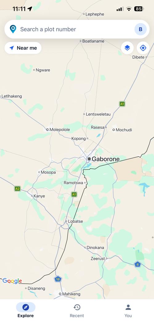
Search by plot number
The one thing everybody came to do. Type it, and the map goes there — no browsing, no wards, no guessing at a suburb name.
See every match
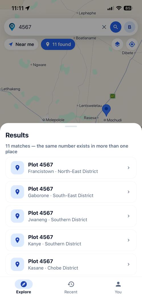
Plot numbers repeat across Botswana. PlotFinder shows you all of them with their town and district, rather than picking one and hoping.
Get directions
Pick the right one and hand the driving to Google Maps or Waze — the app you already use, with the traffic it already knows.
The problem nothing else solves
One number. Eleven places.
A plot number is not unique in Botswana. The same number is used in Francistown and in Gaborone and in Kasane, and sometimes twice in one town, kilometres apart. Anybody who has been handed “Plot 4567” and a phone number knows how that ends.
So PlotFinder never guesses. A search returns every match, each with its town and its district, and you choose the one you meant. It is the difference between a map that answers the question and a map that answers a different one confidently.
On the map, not in a list
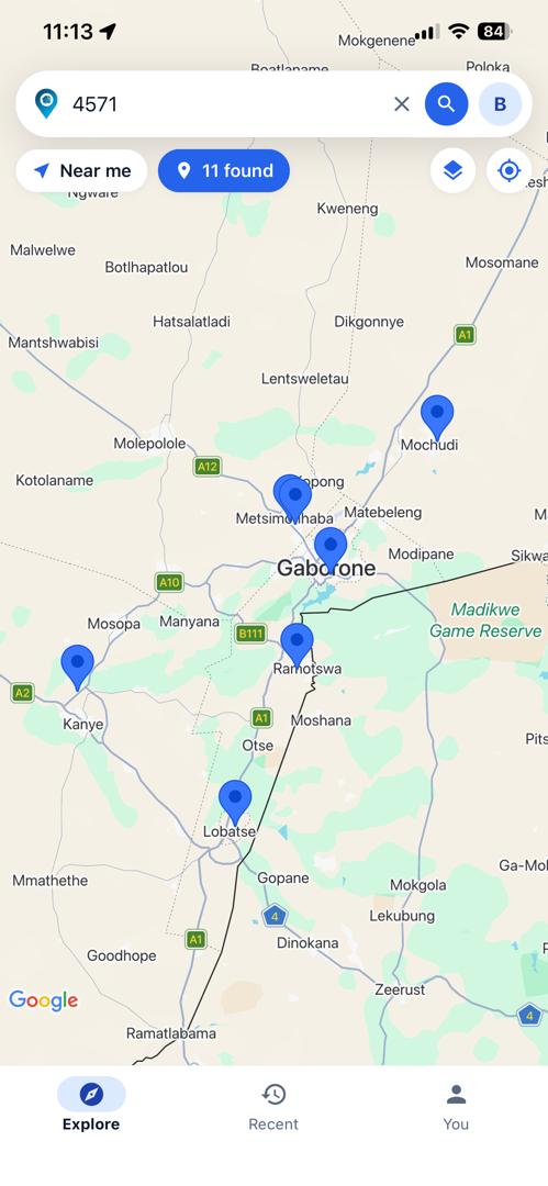
See the matches spread out
Every match is a pin, so the shape of the answer is obvious before you read a single row. Two candidates in the same suburb is a different problem from one in Kanye and one in Mochudi, and the map tells you which you have.
Switch to satellite imagery to see what is actually on the ground, or open Street View at the pin when you want to recognise the gate before you get there.
Where it covers
- Towns & villages
- 449
- Districts
- All of them
- Surveyed plots
- Every one on file
Gaborone, Francistown, Molepolole, Maun, Serowe, Selibe Phikwe, Kanye, Mahalapye, Mochudi, Palapye, Lobatse, Ramotswa, Mogoditshane, Jwaneng, Kasane, Tlokweng and the rest — every plot carrying the district it falls in.
Plans
Free is a plan, not a trial
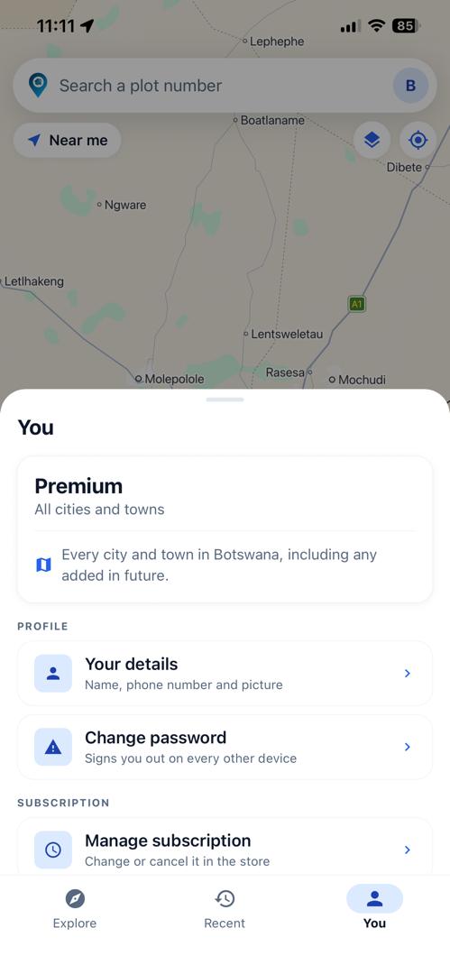
The free plan searches the town you are in, with a small daily allowance of directions, and it does not expire. What a subscription buys is searching a town you are not in — one town, five you choose, or all of Botswana.
Prices are set per plan and charged by the App Store or Google Play in your own currency. Nothing is charged without you confirming it in the store.
Questions people ask
What is PlotFinder?
PlotFinder is a mobile app by Starlight Software Solutions that turns a Botswana plot number into a place on the map. Type the plot number, see every plot carrying it with its town and district, and get directions to the one you mean.
How do I find a plot in Botswana by its plot number?
Open PlotFinder, type the plot number and search. Every plot with that number appears as a pin with its town and district; pick one to see it on the map or on satellite imagery, then tap Directions to drive there with Google Maps or Waze.
Which towns does PlotFinder cover?
449 towns and villages across Botswana, including Gaborone, Francistown, Molepolole, Maun, Serowe, Selibe Phikwe, Kanye, Mahalapye, Mochudi, Palapye, Lobatse, Ramotswa, Mogoditshane, Jwaneng, Kasane and Tlokweng. Every plot carries the district it falls in.
Is PlotFinder free?
Yes. The free plan searches the town you are in and includes a daily allowance of directions, with no card and no expiry. The Basic, Standard, Premium plans let you search towns you are not in, and are charged by the App Store or Google Play in your own currency.
Why does one plot number show several places?
Plot numbers are not unique in Botswana: the same number is used in different towns, and sometimes twice within one town kilometres apart. PlotFinder shows every match with its town and district so you choose the right one, rather than the app guessing.
Can I get directions to a plot?
Yes. Choose the plot and tap Directions. PlotFinder hands the route to Google Maps or Waze, from where you are or from another plot number, so you drive with the traffic those apps already know.
Is PlotFinder's plot data an official survey?
No. The plot data shows where a registered plot number sits and is reference information, not a cadastral survey. It does not establish a boundary and is not evidence of ownership; the terms of use say so in full.
Where can I download PlotFinder?
PlotFinder is on Google Play. The the App Store version is on its way; the download links on this page are the place to check.
Can a business use PlotFinder's plot data?
Yes, under contract, through a documented API covering Botswana and South Africa: plot lookup and parcel intelligence, with more products following. The developer documentation is at api.starlightsoftware.co.bw/docs.
Your account, and what we hold
No advertising, no analytics, no tracking — there are no third-party advertising or analytics libraries in the app at all. Location is read while the app is open, to work out which town you are in; your coordinates are not stored. The list of plots you have opened lives on the phone and never reaches us.
- Privacy policy — what is collected, why, and what deliberately is not.
- Delete your account — in the app, or by asking us after you have uninstalled it.
- Terms of use — including the accuracy disclaimer above.
- Support — one address, read by the people who build it.
Using the data in your own systems
The plot and parcel data behind PlotFinder is available to businesses under contract, as a documented API covering Botswana and South Africa — plot lookup, parcel intelligence, encumbrances and jurisdiction. Read the developer documentation, or write to info@starlightsoftware.co.bw.